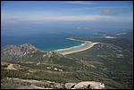
Mount Oberon, Wilsons Promontory
 mo1.jpg |
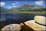
Welcome to Norman Beach! Norman Beach, the main beach for the Tidal River camping ground at Wilsons Promontory, fronts Tidal River, which drains a valley between a series of peaks reaching up to about 1000 metres above sea level (mASL). Mount Oberon (seen here, with Little Oberon to the right) rises to about 558 mASL. Note that the slopes in this picture are well vegetated with a combination of heath and closed dry sclerophyll forest. This picture was taken from Norman Beach late in the afternoon during low tide. Nice, isn't it? |
||||||
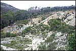
 mo2.jpg |
Mount Oberon, seen from Tidal River, looms over the camping ground. Mount Oberon is composed of granite, part of the the large Middle Devonian Wilsons Promontory Batholith. Some granite tors are shown in the foreground, partially flooded by water in Tidal River. Mount Oberon has large tors and pavements of granite, visible in this photo. |
||||||
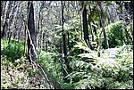
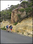
 mo3.jpg |
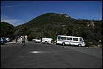
Welcome to Mount Oberon. This view looks west from the car park at Telegraph Saddle (about 180 mASL), at the start of the walking track to the peak, from which you can see Tasmania! This car park is also the start for walking tracks to Sealers Cove, Waterloo Bay and the South Point lighthouse. Note that the hillside is thickly vegetated with a combination of eucalypts, casuarinas, shrubs and other smaller species. On the walk to the top we'll be looking at these in more detail. |
||||||
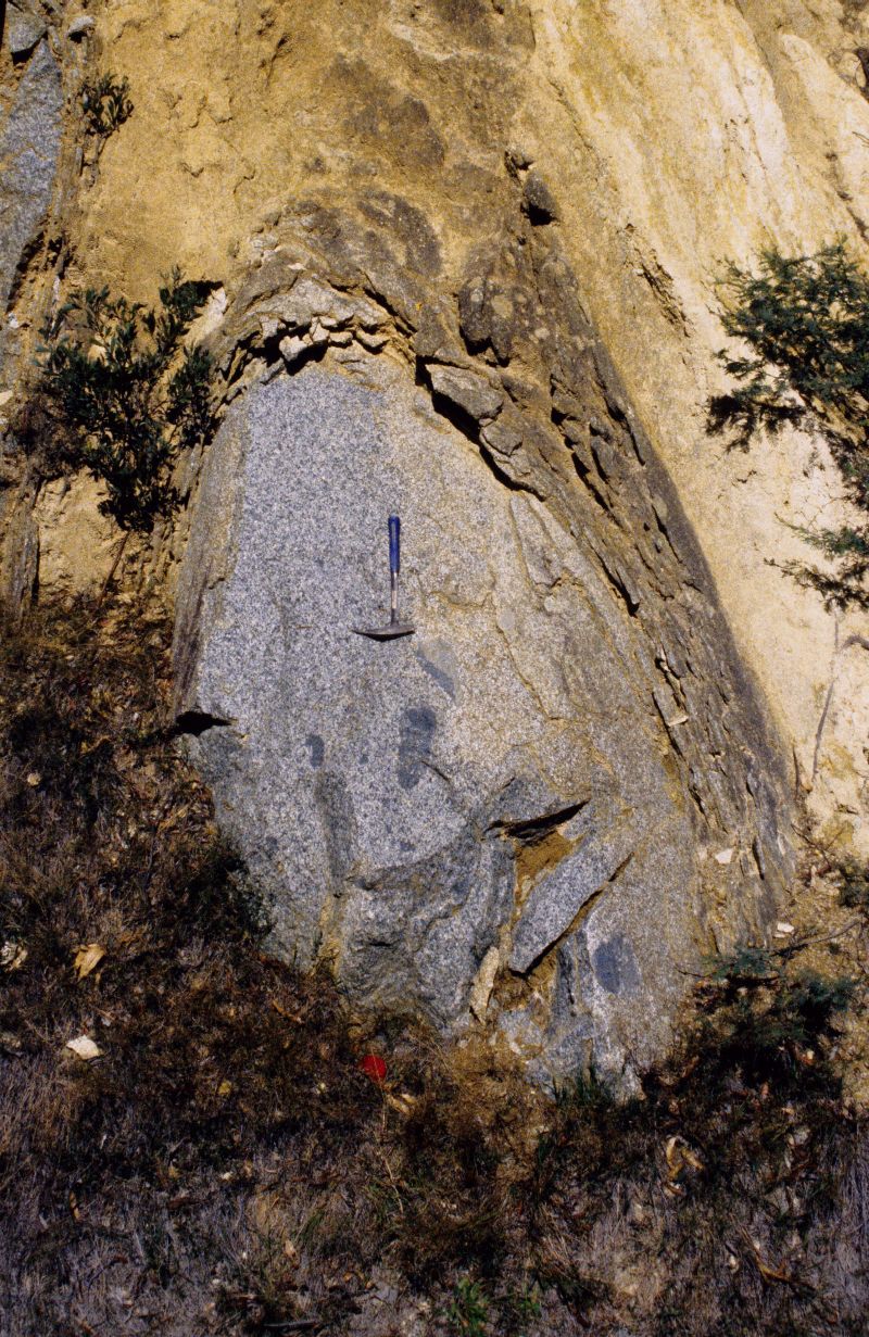
 mo4.jpg |
One of the most striking features about Wilsons Promontory is the granite landscapes. Many of the hills and mountains have striking granite pavements and tor fields, like this one. What are tors, and how do they form? A tor is a rounded boulder, generally composed of a coarse-grained igneous rock, which stands free on the land surface. At Wilsons Promontory the tors range from less than 1 m diameter to tens of meters diameter, often with smaller ones stacked on top (like in the main picture). How do tors form? Actually, most of the hard work occurs underground; tors form by chemical weathering whilst buried in the regolith. Water containing oxygen and weak acids attacks rock masses underground along joints and fractures to form corestones, or incipient tors. In the case of most granites, these fractures are generally arranged orthogonally (cube-shaped) below the ground surface. Chemical weathering occurs along the joints and fractures, slowly penetrating the rock mass and converting the primary minerals to secondary ones. The corners of the corestones are slowly rounded off because weathering attacks the rock mass from two sides. Gradually, the corestones are rounded off by chemical weathering to form incipient tors, but are exposed at the surface only where physical weathering and erosion takes place. This form of weathering is also called "onionskin weathering". The photos below illustrate some of the features of corestone formation:
|
||||||
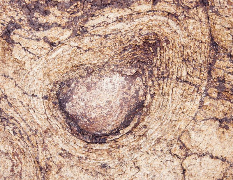
 mo5.jpg |
The summit of Mount Oberon is a granite dome. Granite domes feature convex to flat pavements of bare rock which often suffer more from physical weathering than chemical weathering, and break off in large sheets by "spalling". Spalls occur by the thermal expansion and contraction on the rock surface enlarging pre-existing, or creating new, microfractures in the rock. The microfractures are sub-parallel to the rock surface and are caused by unloading as surface materials are eroded away over geological time. As the rock heats and cools from day-time to night-time temperatures, the microfractures enlarge, eventually releasing sheets of rock that may be several tens of centimetres thick and many meters long and wide, depending on the average grain size. These can then slide off the rock face to leave fresh rock underneath, making it hard for vegetation to get a hold. Spalling is a different process to the shrinking and swelling that forms concentric weathering rinds |
||||||
 mo6.jpg |
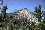
Vegetation on Mount Oberon consists of dry sclerophyll forest on the slopes. Drainage depressions are normally wetter and filled with tree ferns, bracken fern and spear grass in the understorey. In this image, understorey vegetation along a drainage depression is dominated by tree ferns including the soft tree fern (Dicksonia antarctica) and the rough tree fern (Cyathea australis) and numerous species of ground ferns. The trees growing here principally include the messmate (Eucalyptus obliqua). |
||||||
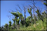 mo7.jpg |
Regrowth after the bushfires of 2005. Bushfires are major agents of change in the regolith. Understorey vegetation, normally responsible for binding the regolith together, is burnt and removed leaving the regolith susceptible to erosion by rain, wind and mass flow. In this image the messmate eucalypts are growing back from buds under their bark - they are quite well adapted to frequent burning. Others of the eucalypt species at Wilsons Promontory are not so lucky and are killed by bushfires (e.g., the mountain ash Eucalyptus regnans). |
||||||
 mo8.jpg |
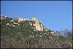
View towards Little Oberon and Little Oberon Bay from the top of Mt Oberon. Notice the steep sides of the granite domes on both Mt Oberon and Little Oberon. They are largely devoid of vegetation except where it manages to cling to clefts in the rock faces. The smooth, convex rock faces are the product of spalling which, in effect, is a continuation of the onionskin weathering that rounds the edges off the fractured blocks of granite underground before they are exposed by erosion at the earth's surface. Spalled sheets and tumbled tors and blocks form thick colluvial footslopes around the bases of Mt Oberon and Little Oberon. You can learn more about colluvial processes at Oberon Bay. |
||||||
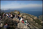 mo9.jpg |
Teaching on top of Mt Oberon - what a great place to hold lectures! On a clear day you can see Tasmania from here... actually, its northern islands (not the main island itself). |
||||||
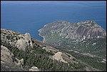
 mox10.jpg |
The view north from the top of Mt Oberon takes in many of the major regolith features of south-western Wilsons Promontory. From here you can see Little Oberon (left), Norman Bay and Tidal River, Tidal Overlook and Squeaky Beach in the distance. You can also see many of these features in the regolith-landform map of Tidal River. Why don't you spend some time comparing this photo to the regolith-landform map? Notice the morphology of the coastline. It's a series of steep-sided headlands separated by curved beaches with estuaries and swamps behind the beach dunes. This landscape is known as a steep coast (E.S. Hills 1975) or a cliffed coast (E.C.F. Bird 1984) and is typical of the eastern seaboard of Australia; it is a drowned landscape. This landscape is actually fairly recent, the product of sea level change (eustacy) during the Pleistocene glacial cycles. During the last glacial maximum, when sea levels were up to 100 m lower that present, the steep-sided erosional valleys were largely empty of sediment and extended out to the continental shelf. The modern estuaries have only been established in the last 15,000-10,000 years since the end of the last glacial maximum and the return of the sea to its present level. The estuaries are filled with a combination of sand from eroding Wilsons Promontory granite plus some silts, clays and peaty Potential Acid Sulfate Soil (PASS) deposits which, if drained, would become Actual Acid Sulfate Soils (AASS). You can learn more about PASS and AASS at Red Bluff and Flynns Beach. |
||||||
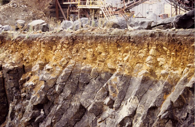
 mox11.jpg |
Mt Oberon Quarry, previously used to extract weathered granite for use as road aggregate, is now being rehabilitated by planting native shrubs and trees and by building stabilizing bunds. The old quarry is a useful field site because you can observe weathering features off the roadside - the road to Telegraph Saddle is very narrow! At this site it is possible to see in situ weathered granite, granite tors and weathered granite colluvium. Notice, also, the red soils visible in top of the quarry face? These are red-coloured soils consisting of fine sand, and are a continuation of the aeolian sand sheet that wraps around the north-facing foot of Mount Oberon. |
||||||
 mox12.jpg |
Tor cross-section at Mt Oberon saddle. The solid tor is embedded in "grus", or granite saprolite. The grus can be fragmented by hand, but still maintains the original igneous fabric of the granite parent material. Thus it has weathered almost isovolumetrically (with the same - iso - volume). Walk along this road cutting and you can see numerous other tors exposed by road building. They all have onion-skin weathered sides and bases where they contact the surrounding saprolite. The exposed surfaces are undergoing spalling. |
||||||
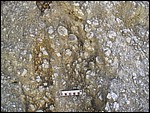 mox13.jpg |
Weathered Wilsons Promontory granite. What's going on in this picture? The typical mineralogy of a granite is quartz + plagioclase + orthoclase +/- muscovite + ferromagnesian minerals (biotite, hornblende, pyroxene) + accessory minerals (zircon, apatite). The Goldich weathering order of the major minerals is plagioclase + ferromagnesians > orthoclase > quartz. In this case the large crystals (orthoclase or K-feldspar) are megacrysts up to 4-5 cm diameter and, while being weathered, are actually chemically and physically weathering more slowly than the surrounding groundmass because of their size. |
||||||
Learn more about Mt Oberon, granite weathering at Wilsons Promontory and drowned landscapes by reading: W.D. Birch ed. 2003. Geology of Victoria. Geological Society of Australia special publication No. 23. 842 p. |
|||||||