research program 4
salinity mapping and hazard assessment
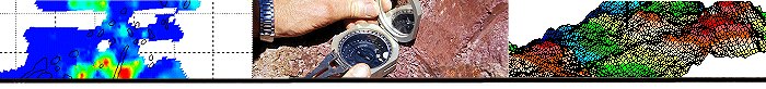
Sunraysia AEM Acquisition and Interpretation: Final Reporting Phase
Development and implementation of salinity management initiatives in the Sunraysia region by improving our understanding of the regional hydrogeology using airborne geophysical data
Project Leader : Tim Mundaym CSIRO Exploration and mining
Start date and duration: June 2007 (6 months)
Participants : CSIRO Exploration and Mining, Golburn-Murray Water, Geoscience Australia
Brief project description :
The Mallee Murray irrigation region supports a nationally significant citrus, vegetable production and horticulture industry. This industry is dependent upon the Murray River supplying water for irrigation, household use, livestock consumption, and industrial water use - accounting for nearly half the total water use across the Mallee. Salinisation of the Murray River is a significant threat to the sustainability of the irrigation resource for this region. Natural inflows of highly saline groundwater to the River Murray have been exacerbated by irrigation development and adjacent clearing of dryland within the vicinity of the river. Future irrigation development and the delayed impacts of land clearing in the dryland farming area will continue to increase these inflows into the future.The principle asset at risk is the Murray River, that supplies potable and irrigation water to the immediate region and downstream. Salt-interception schemes are an important feature to protect water quality. However, key to their development and effectiveness is information on the:
- The spatial and temporal distribution of sub-surface saline inflows into the Murray River and their relationship with land use change
- Salt build up in the Mallee floodplain which presents a significant risk to River Murray salinity
- The recognition of high and low irrigation impact zones
- The appropriate location for salt interception high yielding production bores.
It is expected that significant green-field' developments will continue to occur into at least the mediumterm adding further pressure to the supply of water and the protection of river and floodplain values.
Geophysical methods have the capacity to provide detailed spatial information to assist in the prediction of the impact of current and future irrigation developments, the design of salt interception schemes and protection of floodplain values. These issues are central to the regional and state strategies for the River Murray. The project has been initiated by the Sunraysia Salt Interception Integration and Optimisation Steering Committee and Project Board (MDB Ministerial Council Endorsed with MDBC approved work plan) in support of two of their high priority projects - A Sunraysia Regional Disposal Strategy (MDBC Funded) and the Refurbishment Planning for the ageing and underperforming Mildura-Merbein Salt Interception scheme (G-MW/MDBC co-funded). Project outputs will assist in the maintenance and development of enhanced environmental values for the floodplain and river through a mix of management strategies.
Specific project objectives
In this, the final six months of the project, focus will be on the delivery of Final Project Reports, the conduct of workshops for project stakeholders and the preparation of papers for presentation and publication. More generally outputs would address the following aims:
For Mildura-Merbein SIS:
- Reduce number of investigation wells required in order to inform design of groundwater management option(s), and provide for more targeted drilling reducing costs and environmental impacts, by providing an understanding of the distribution of near surface salt stores and materials in the floodplain and their relationship with in-river salinity
- Identify recharge areas postulated as attributing to post flood salt inflows, and
- Identify boundary of flushed zone induced by river regulation.
- Map variations in groundwater conductivity
- Map variations in aquifer porosity
For Kings Billabong:
- Identify salt stores and lithological variation in the Quaternary alluvium (Qa).
- Identify the main saline fluxes to the billabong system
- Identify flush zones and recharge areas in the floodplain sediments (Qa).
- Map the water table surface.
- Map the distribution of the single, composite Channel Sands-Parilla Sand aquifer and if possible variations associated with other sedimentary units (the Blanchetown Clay/upper Parilla Sand aquitard)
- identify the preferred groundwater flow paths emanating from the regulated storages
For Red Cliffs
- Provide baseline data on salt storage in floodplain sediments
- Determine recharge/discharge areas, and provide insights into floodplain processes
- Define the extent of the flushed zone adjacent to the river
- Map variations in groundwater salinity
For In River Salinity
- Trial HEM data as a source of data for river bed salinty
- Compare results against NanoTEM run of river EM survey
- Provide a qualified assessment of in river geophysical survey techniques including Run of River survey data.
- Provide core and associated analytical data that will validate in river NanoTEM and Helicopter EM data collected in the Sunraysia region.
Deliverables (outputs) and expected impacts of research (outcomes):
Outputs
- A Final Project report on the HEM data interpretation incorporating the floodplain coring information and analyses. The report will include results from the constrained inversion of HEM data, the procedure used, and limitations of derived products. The derived interpretations will include geological and geophysical information from new bores being drilled in the area over the April-June 07 period. Final results will be workshopped with Stakeholders.
- Presentation of a report and workshop on the assessment of in river survey technologies
- Presentation of a report and workshop on validated in river nanoTEM data
- Preparation and presentation of 4 papers on Sunraysia work at the following meetings: Near Surface Geophysics (Sept 07), ISF meeting (April 08), Water Down Under 2008 (April 08), AEM'08 (May 08).
Outcomes
- Enhanced ecological outcomes for environmental, social and economic benefit from Australia 's floodplains and groundwater dependent ecosystems
- An understanding of spatial patterns of floodplain salinity and the River will deliver improved biophysical constraint for various salinity management initiatives being developed in the Sunraysia region. We anticipate that project outputs will assist in the maintenance and development of enhanced environmental values for the floodplain and river through a mix of management strategies.
- Project outcomes will directly support the further development of a region-wide numerical groundwater modelling package capable of meeting the MDBC requirements for Salinity Register (A) assessments, given the current suite of tools all suffer from a lack of detailed understanding of floodplain processes and in particular the attenuation and release mechanisms of salt stores on the flood plain and the spatial variability of these processes. Confidence in the modelling environment is considered critical in both the design of salt interception infrastructure and the assignment of credits and debits to the MDBC salinity registers.
|