research program 4
salinity mapping and hazard assessment
SA Murray Floodplain: Final Reporting Phase.
Hydrogeological studies of River Murray Floodplains, Riverland, South Australia using airborne and ground geophysical techniques
Project Leader : Tim Munday, CSIRO Exploration and Mining
Start date and duration: August 2005 to December 2007
Participants : CSIRO ExploratiOn and Mining, CSIRO Land and Water, Geoscience Australia, SA Water, Dept of Water, Land and Biodiversity Conservation SA
Brief project description :
This project focuses on analysis and interpretation of ground and airborne (AEM) geophysical data across the Chowilla SEA and Bookpurnong floodplains, informing the Chowilla Integrated Natural Resource Management Project and the Bookpurnong Floodplain Pilot Project which are funded by the NAP, MDBC, DWLBC and NHT. Floodplains of the River Murray are a potential source of salt and other contaminants to the river, due to their role in intercepting saline groundwater discharge. The roles of surface watergroundwater interactions in wetland soil and water chemistry, and the resultant biotic responses are poorly known. The connectivity of the surface and groundwater depends on regional hydrogeology and wetland geomorphology, and will also be affected by operations such as wetland wetting-and-drying cycles and groundwater interception. Regional groundwater is highly saline, anoxic and reduced, impacting wetland water quality and habitat. The knowledge gap in water interactions in wetlands, and impact of water quality on ecology and biodiversity, is a shortcoming in our ability to determine the most appropriate way of managing wetlands of the lower River Murray.
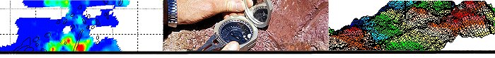
New geophysical techniques have been applied to derive soil-regolith and salt store maps that would help identify local recharge and discharge areas, and likely effects on river salinity. The role of electrical geophysical methods to map spatial and temporal variations of salinity linked to environmental flow management in particular test sites in the Riverland area has been reviewed. We believe the geophysical data, when linked to detailed ground investigations, provide an understanding of causal links between in-river salinity, floodplain and upland aquifer characteristics, and discharge processes, and opine that this will have environmental benefits to the River and its wetlands, and salinity benefits to ecologically important floodplain areas.
This work built on knowledge from the SA-SMMSP in the Bookpurnong area, which demonstrated that geophysical methods do provide detailed spatial information to assist in the prediction of irrigation impacts, the design of salt interception schemes, and protection of floodplain values in the Riverland region. These issues are central to the regional and state strategies for the River Murray and are identified as key targets in the SA MDB INRM Plan (2003).
Project Objectives
Principal objectives for the final 6 month of the project are to report on its findings, present a workshop on the outcomes to stakeholders, and to prepare and present papers on the results. Overall the project had the following objectives:
• To determine the value of airborne geophysics in helping define and protect groundwater dependent ecosystems on the Chowilla floodplains.
• To relate run-of-river salinity to variations in floodplain aquifer and soil characteristics
• To map salt stores and soil variability in the Chowilla Floodplain and over Bookpurnong Floodplain Pilot Project site using helicopter electromagnetic data processed using local constraints.
• To report on spatial-temporal ground geophysical monitoring techniques and their application to floodplain studies at Bookpurnong and Chowilla
• To deliver a report detailing the relationship between soils and aquifers, as determined by geophysics and drilling, the siting of irrigation developments, and time delays between changed land use and impact on river.
Deliverables (outputs) and expected impacts of research (outcomes):
Deliverables area primarily limited to reports, GIS coverages of data layers derived from the constrained inversion of HEM and ground data, and papers and/or extended abstracts. Reports to be completed in first half of FY 07-08 include:
- AEM for management of groundwater dependent ecosystems on salinising floodplain (July 2007)
- The application of ground geophysical techniques for understanding spatio-temporal patterns and processes associated with environmental flow management on the Murray floodplains, SA (Sept 2007)
- A CRCLEME/CSIRO LW Technical report on modelling the effects of spatially variable recharge to the Loxton Parilla aquifer at Bookpurnong, and the role of variable transmissivity linked to facies variations in the aquifer. This work will link upland processes with floodplain transmissivity, to determine the effect of aquifer heterogeneity on groundwater flow patters across the floodplain. It will also determine whether additional modelling is necessary (October 2007) .
- Project Summary Report HEM for floodplain process determination (October 2007)
Outcomes
The project addresses key strategies and actions defined as Essential in the River Murray Salinity Strategy, the Dryland Salinity Strategy, and the River Murray Catchment Water Management Plans. Additional airborne geophysics in the River Murray floodplain will be a critical bridging link between land characteristics and groundwater processes in upland and floodplain regions. These data will promote an understanding of causal links between in-river salinity and floodplain and upland aquifer characteristics and discharge processes. The outcomes will influence the location and effectiveness of SIS and affect policy irrigation development and salinity credits.
Key outcomes for the project are:
1. The provision of baseline data on the spatial distribution of near surface salt stores and materials in the floodplain and their relationship with in-river salinity. Project outputs will assist in the maintenance and development of enhanced environmental values for the Chowilla floodplain and river through a mix of management strategies
2. Determining the value of airborne geophysics for informing the management of other floodplains areas in the Murray Basin
3. Cost effective and efficient SIS design and development
4. Better informed policy on irrigation development and water use efficiency
5. The development of an internal (SA Govt Department) capacity to use airborne geophysical data linked to on-ground investigations in hydrogeological applications.
|