research program 4
salinity mapping and hazard assessment
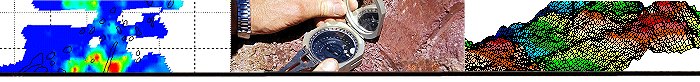
Landscape analysis Murray Darling Basin
Explanation of landscape variation in upland landscapes in the MDB
Project Leader : Colin Pain, Geoscience Australia
Start date and duration: 1 July 2007 30 June 2008
Participants : Geoscience Australia, Australian National University
Brief project description :
Knowledge to date
Knowledge to date
The focus of this project in the final year of LEME is to synthesise results from various projects to maximize the learnings on landscape characterization and evolution, particularly in the Murray-Darling Basin . This work will:
- Provide a basis for extrapolation from small to large catchments in eastern Australia
- Develop regolith and bedrock models, including ages, to understand catchment and salinity processes at different scales.
- Continue analyses of samples collected during the 06-07 year. This will continue cosmogenic isotope work to assess rates of erosion on different landscape positions. This in turn will be used to support earlier work by John Wilford that relates radiometric signatures to the degree of weathering I different landscape types in the upland areas of the Murray Darling Basin . There is also a student honours project being carried out on a similar topic in the same area.
- Following a review carried out to assess the translation of P4 project results to the national/international peer-reviewed literature, this project allows for minor targeted geochronology and geochemical work to bring results to an appropriate standard for publication in peer-reviewed journals, and to provide a firm scientific basis for knowledge and technology transfer.
- The Physiographic Regions project in P1 developed the criteria for upper level mapping related to soils and regolith in the Australian Soil Resources Information System (ASRIS). The Landscape Analysis project will use the ASRIS mapping hierarchy together with an understanding of regolith and landforms and how they have evolved to develop an understanding of the landscapes that will allow us to more confidently predict regolith distribution.
- Following from point 5, Catchment Management Authorities in NSW work on a three-tiered system of land subdivisions, from large to small: Groundwater Flow Systems (GFS), Hydrogeomorphic Units (HGU), and Land Management Units (LMU). Our studies in Victoria , as part of the MDBC project, in the Bet Bet and Loden Catchments in Victoria will feed into the Landscape Analysis project described here to provide a firm descriptive and evolutionary framework for CMAs.
Deliverables
Outputs
- A legacy report (with database and GIS) that compiles all available K/Ar and Ar/Ar age dates and OSL age dates for the Cenozoic in Eastern Australia (Preliminary work has identified over 1400 previously unpublished data points).
- A legacy report that sets out the methodologies, the scientific background, and example maps for landscape analysis in Eastern Australia .
- Demonstration products in support of salinity management interventions at sub-catchment or whole-of-catchment scales
- A workshop on results will be presented to the Australia New Zealand Geomorphology Group meeting in February 2008 to release products and test the science against a leading peer group of geomorphologists.
- Note this project links to the DEM Volume legacy product- A special issue of the International Journal of Remote Sensing is being prepared; many of the papers are outcomes from, and will provide peer-reviewed background to, the results obtained from this project.
Outcomes
Demonstration of the value to salinity management of advances in understanding of:
- Controls on regolith distribution and variability within catchments in eastern Australia .
- Sources of signals received by gamma ray instruments and presented on radiometric images (key to moving towards production of 3D soil and recharge maps).
- The 3D variability of materials in small and large catchments and its influence on salt storage and mobility.
- Significantly improved regional natural resource management tools;
- Demonstration of methods of extrapolation using a hierarchical mapping system.
Impacts
- Better understanding by CMAs of the importance and scale of landform and regolith for NRM, initially the management of salinity
- Ability to consider whole-of-catchment management options.
- Increased confidence in modelling results.
|