31 March - 3 April 2008, Adelaide, SA.
Major contribution from LEME Researchers and Students
- emanating from projects within LEME Program 3: Environmental Applications of Regolith Geoscience (Leader Dr Paul Shand), and Program 4: Salinity Mapping and Hazard Assessment (Leader Dr Ken Lawrie)
WORKSHOPS
http://www.internationalsalinityforum.org/12_specialevent.html
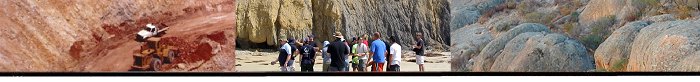
Airborne Electromagnetics (AEM) for Groundwater and Salinity Mapping and Broader NRM Applicatins. LEME presenters - Tim Munday, Ken Lawrie, Andrew Fitzpatrick
Catchment Characterisation Workshop: Are we adding value to existing approaches? LEME presenters Steve Rogers, Colin Pain, David Gibson, John Wilford, Jon Clarke
PRESENTATIONS AND POSTERS
http://www.internationalsalinityforum.org/03_Program.html
- Bann G and Field J. Dryland salinity and terrestrial biodiversity in southeastern Australia: surviving comes naturally.
- Bann G. Dryland salinity, agriculture and soil degradation: what's the link? (poster)
- Bann G. Dryland salinity in southern Australia: primary, secondary, or both, and subsequent management issues (poster)
- Beavis SG, Welch SA, Higgins A and Kirste D. Salt cycling in bottom sediments of a salt disposal basin, Loveday Lagoon, South Australia : implications for management under drought or changing climate.
- Clarke JDA and Lawrie K. Utilising contemporary geoscience methods and models to map aquifer and salinity systems in 3-D, and provide greater precision in the quantification of groundwater resource.
- Clarke J. An airborne electromagnetic (AEM) survey used as a precision investigation tool to address salinity and land management issues in the River Murray corridor, SE Australia.
- Cresswell R. CRESSWELL drives salinity? A personal view of dryland salinity in Australia.
- Dhu T and Heinson GS. Electrical conductivity mapping of salinity: a new fractal approach.
- Fitzpatrick A, Munday T, Fulton S, Brodie RC, Tan KP, Cahill K and Cornelius A. Defining the magnitude and spatial patterns of floodplain salt storage and links with floodplain processes and vegetation health over the Kings Billa Bong floodplain of the Victorian Mallee, South-Central Australia.
- Fitzpatrick RW, Degens BP, Baker AKM, Raven MD, Shand P, Smith M, Rogers SL and George RJ. Geochemical risks of saline acidic discharge from deep drains used to manage dryland salinity in Western Australia . Hydro-pedological, biogeochemical and mineralogical processes.
- Fitzpatrick RW. Geochemistry and mineralogy of sulfidic drains in Tilley Swamp, South Australia.
- George R, Clarke JDA and English P. Cainozoic and modern salinisation and desalinisation of the Wheat Belt of Western Australia.
- Gibson D. Landscape evolution: a component of catchment characterization.
- Gidfedder M. An overview of catchment-scale salt mobilisation models.
- Ginnivan J, Mathers K. Munday T, Pfeiffer P, Sutherland G, Tatnell B, Amoafo B, Telfer A and Fitzpatrick A. Supporting the development and implementation of salinity management initiatives in the Sunraysia region in Victoria and NSW by enhancing our understanding of the regional hydrogeology through airborne geophysical data.
- Halas L, Clarke JDA an Tan KP. Integrated geomorphic techniques for the mapping of the Murray River Floodplain, South Australia using high-resolution DEM dataset.
- Hatch M. Fitzpatrick A, Munday T, Allen D, Porter B and Telfer A. Techniques for defining variations in riverbed salt loads as an aid to managing river salinisation and the deterioration of nationally significant water resources.
- Heinson G, Costar A, Wilson T, Love A and Smit Z. Remote monitoring of groundwater flow in fractured rock using electrokinetic methods.
- Heinson G. Electrical conductivity mapping of salinity: a new fractal approach.
- James JM. A rapid approach to catchment characterisation for salinity and groundwater management in Australian upland landscapes: a cast study of the Gardiner Catchment area, central Victoria.
- Lawrie KC. KEYNOTE. What salinity threat? Technologies and methods for mapping, predicting and managing salinity. To what extent can recent advances in salinity mapping assessment create new salinity management (and policy) opportunities.
- Lawrie KC, Clarke JDA, Tan KP, Pain CF, Brodie R, Edwards D, Reid M, Apps HEJ, Wong VNL and Luckman J. An airborne electromagnetic (AEM) survey used as a precision investigation tool to address salinity and land management issues in the River Murray Corridor, south east Australia.
- Lenahan MJ and Cresswell RG. Geochemical evolution of saline groundwater in the unsaturated zone. (Paper)
- Munday T, Overton I and Fitzpatrick A. Managing and protecting the local ecology and biodiversity of the Lower Murray River floodplains in SE Australia using biophysical data derived from airborne EM survey data. (Paper)
- Munday T, Fitzpatrick A, Pocaro C, Brodie RC, Cahill K. Saline water disposal basin hydrodynamics as evidenced through the application of airborne geophysics. (Poster)
- Pain CF. Multi-scale landscape mapping for catchment characterisation.
- Rogers SL, Degens BP, Fitzpatrick RW, Douglas GB, George RJ, Shand P, Lillicrap A and Gray DJ. Geochemical implications of salinity mitigation drainage engineering options - A global overview.
- Tan KP, Munday TJ, Graham T, Holmes K, Cahill K and Fitzpatrick A. An investigation of river and floodplain sedimentary systems and salinity along the Murray River using advanced coring technologies.
- Tan KP, Lawrie KC, Clarke JDA, Reid M, Wong VNL, Luckman J, Apps NEJ and Edwards D. Airborne electromagnetic methods used in an integrated approach to assess salinity-related irrigation impacts on the Murray River Floodplain.
- Wilford J, James J and Halas L. Defining and evaluating hydrogeological-landscapes in upland regions of Eastern Australia for salinity and water resource management.
- Wilkes. P. Geophysical investigations in the mitigation of salinity in urban areas of Western Australia.
- Wong VNL. Salt organic carbon fluxes in salt-affected soils.
- Wong VNL, Clarke JDA, Lawrie KC, Tan KP, Apps HEJ, Pain CF, Luckman J and Halas L. Recharge mapping in floodplain environments: utilising airborne electromagnetics to map 'leaky roofs and windows'.
|